mapsExploring Florida
 FL Maps > County > Lafayette > Lafayette County, 1859
Site Map 

Lafayette County, 1859


Puzzle Directions: Click on a puzzle piece and drag it where you want it. When you connect two pieces correctly, they will join together. Mix up the pieces again. View finished map in pop-up window.

Title: Lafayette County
Projection: Unknown
Source Bounding Coordinates:
W: E: N: S:

Back to Map Page
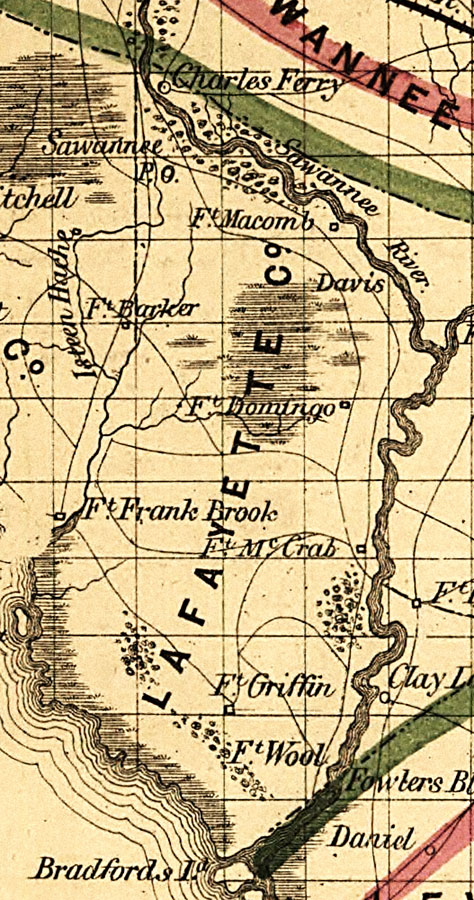
Description: Map of Lafayette County, Florida showing river drainage, U.S. Army forts, roads, and railroads in 1859. Township grids based on the Tallahassee basis parallel and the Tallahassee prime meridian shows the extent of land survey in Florida. The map scale is 1:1,140,480.
Source: , Annual Report of the Surveyor General for 1859 (New York, NY: General Land Office, 1859)
Map Credit: Courtesy of the Geography and Map Division of the Library of Congress.
SearchLicensePDF HelpGIS Help Google Earth Help Zoomify Help

 FL Maps > County > Lafayette > Lafayette County, 1859