mapsExploring Florida
 FL Maps > State > 1900-1919 > Map of Florida, 1902
Site Map 

Map of Florida, 1902


Puzzle Directions: Click on a puzzle piece and drag it where you want it. When you connect two pieces correctly, they will join together. Mix up the pieces again. View finished map in pop-up window.

Title: Map of Florida
Projection: Unknown
Source Bounding Coordinates:
W: -85 E: -79.8 N: 30.5 S: 25

Back to Map Page
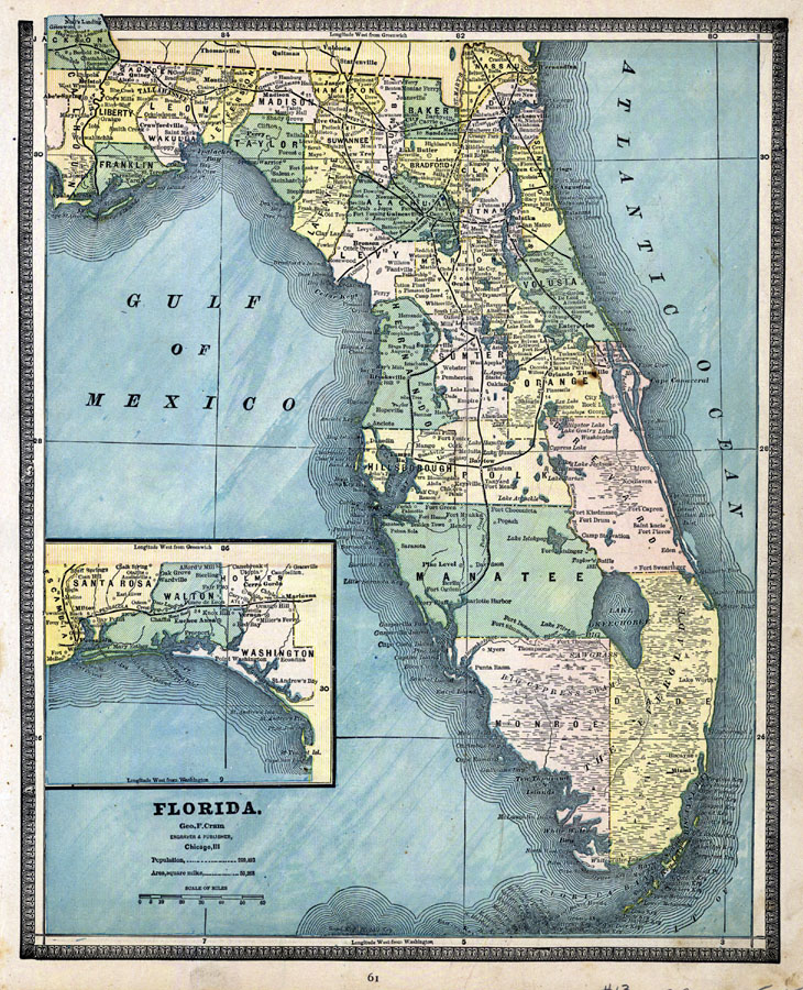
Description: Digitization provided by the USF Libraries Digitization Center. Rare Maps. This is a map of Florida showing the counties, cities and towns, inland waters, railroads, etc, circa 1902. There is also an inset map of the western portion of the panhandle. Measurements.Dimensions: 24 x 32 cm. Measurements.Resolution: Scale 1:1,609,344.
Source: , (Chicago, IL: George F. Cram Company, 1902)
Map Credit: Courtesy of the Special Collections Department, University of South Florida.
SearchLicensePDF HelpGIS Help Google Earth Help Zoomify Help

 FL Maps > State > 1900-1919 > Map of Florida, 1902