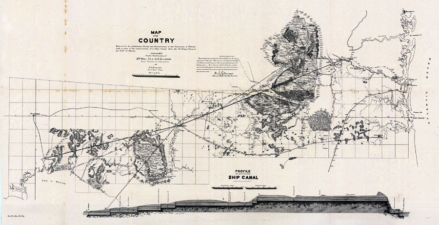
Description: Digitization provided by the USF Libraries Digitization Center. Rare Maps. This is a hand colored map with a view to the construction of a ship canal from the St. Marys River to the Gulf of Mexico circa 1879. There is also a "Profile On Line of Proposed Ship Canal" below. There is also a note from Leut. Col. of Engineers Q. A. Gillmore who was the surveyor. Section Township Range (STR) is shown. Measurements.Dimensions: 35 x 76 cm., on sheet 41 x 79 cm. Measurements.Resolution: Scale [ca. 1:405,500].
Place Names: 1860-1879, Gulf of Mexico, Fernandina, Amelia Island, St. Johns River, Jacksonville, St. Marys River, St. Marks, Tallahassee, Atlantic Ocean
ISO Topic Categories: inlandWaters, boundaries, transportation, oceans
Keywords: Map of the country embraced in the preliminary survey and examination of the peninsula of Florida, physical, historical, political, transportation, physical features, country borders, railroads, water routes, inlandWaters, boundaries, transportation, oceans, Unknown,1879 AD
Source: S. L. Freemont, (New York, NY: United States Army: Corps of Engineers, 1879)
Map Credit: Courtesy of the Special Collections Department, University of South Florida. |
|