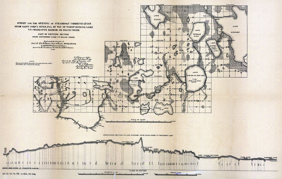
Description: Digitization provided by the USF Libraries Digitization Center. Rare Maps. This is a hand colored map of the opening of steamboat communication from the St. Johns River to Charlotte Harbor western section by way of Tohopokeliga Lake circa 1881. There is also a "Longitudinal Section On Line Surveyed from Peace Creek to Kissimmee Lake" below. There is also a note from Leut. Col. of Engineers Q. A. Gillmore who was the surveyor. Relief shown by spot heights. Elevations in feet. Section Township Range (STR) is shown. Measurements.Dimensions: 35 x 76 cm., on sheet 41 x 79 cm. Measurements.Resolution: Scale [ca. 1:405,500].
Place Names: 1880-1899, Fort Meade, Fort Gardner, Lake Kissimmee, Lake Rosalie, Charlotte Harbor, Peace Creek
ISO Topic Categories: inlandWaters, boundaries
Keywords: Survey for the opening of steamboat communication from Saint John's River, Fla., physical, historical, hydrological, physical features, water depths, inlandWaters, boundaries, Unknown,1881 AD
Source: W. G. Williamson assisted by J. F. LeBaron, J. Gartland & R. Paulson, (New York, NY: United States Army: Corps of Engineers, 1879)
Map Credit: Courtesy of the Special Collections Department, University of South Florida. |
|