mapsExploring Florida
 FL Maps > Region > 1840-1859 > Military map of the peninsula of Florida south of Tampa Bay, 1856 AD
Site Map 

Military map of the peninsula of Florida south of Tampa Bay, 1856 AD


Puzzle Directions: Click on a puzzle piece and drag it where you want it. When you connect two pieces correctly, they will join together. Mix up the pieces again. View finished map in pop-up window.

Title: Military map of the peninsula of Florida south of Tampa Bay
Projection: Unknown
Source Bounding Coordinates:
W: E: N: S:

Back to Map Page
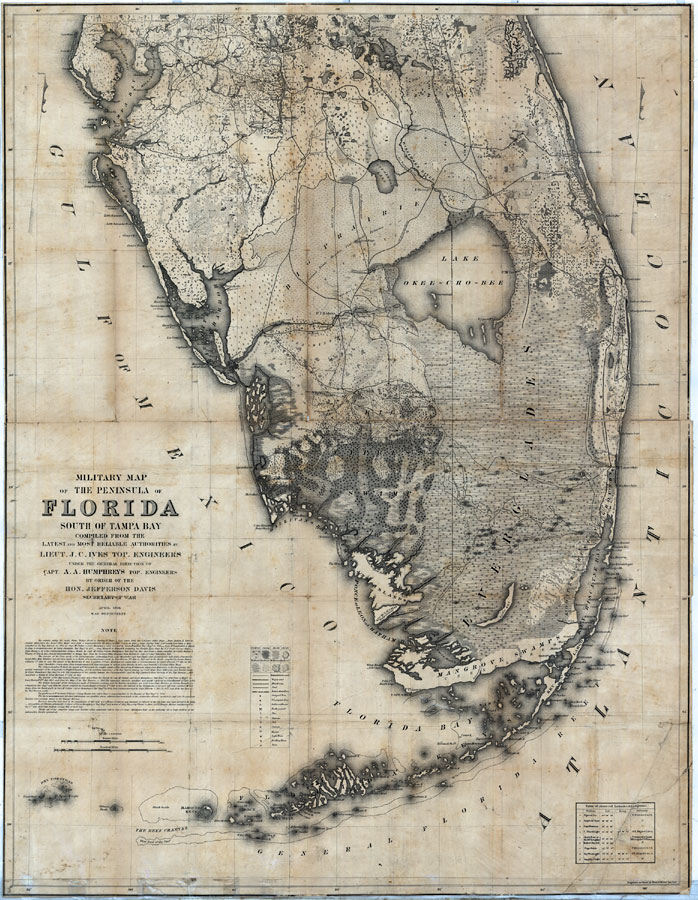
Description: Digitization provided by the USF Libraries Digitization Center. Rare Maps. This is a map of the peninsula Florida from Tampa south compiled by the latest and most reliable authority.showing forts, wagon roads, Indian boundaries, battle grounds, types of trees, light houses and other towns and cities circa 1856. Measurements.Dimensions: 108 x 84 cm. Measurements.Resolution: Scale 1:400,000
Source: Lieut. J. C. Ives under the general direction of Capt. A. A. Humphreys by order of the Hon. Jefferson Davis, (New York, NY: Leve & Alden Printing Co., 1856)
Map Credit: Courtesy of the Special Collections Department, University of South Florida.
SearchLicensePDF HelpGIS Help Google Earth Help Zoomify Help

 FL Maps > Region > 1840-1859 > Military map of the peninsula of Florida south of Tampa Bay, 1856 AD