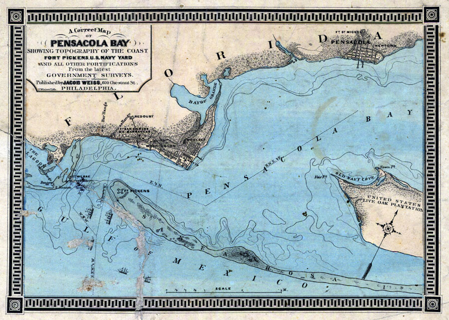
Description: Digitization provided by the USF Libraries Digitization Center. Rare Maps. This is a map of the Pensacola area showing all fortifications including Fort Pickens and topography of the coast from the latest government survey circa 1856. Depths shown by form lines. Measurements.Dimensions: 22 x 31 cm Measurements.Resolution: Scale [ca. 1:62,000].
Place Names: Escambia, Pensacola, Fort Pickens, Gulf of Mexico, Pensacola Bay, Warrington, Woolsey, Santa Rosa Island
ISO Topic Categories: transportation, inlandWaters, oceans, boundaries
Keywords: A correct map of Pensacola Bay, historical, transportation, physical, physical features, topographical, roads, water routes, transportation, inlandWaters, oceans, boundaries, Unknown,1860 AD
Source: , (Philadelphia, PA: Jacob Weiss, 1860)
Map Credit: Courtesy of the Special Collections Department, University of South Florida. |
|