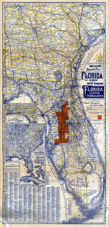
Description: Digitization provided by the USF Libraries Digitization Center. Rare Maps. This is a map of Florida showing complete system of Florida Central and Peninsular railroad, the shortest and quickest route to all points in Florida extending directly through the phosphate and fruit belt circa 1886. Section Township Range (STR) is shown. There is an inset map of the "Western Portion of Florida" and "South Eastern Portion of the U. S. Showing Connections of Florida Central and Peninsular Railroad." Measurements.Dimensions: 83 x 44 cm., on sheet 86 x 46 cm. Measurements.Resolution: Scale [ca. 1:1,126,400]
Source: , (Buffalo, NY: Matthews-Northrup Company, 1886)
Map Credit: Courtesy of the Special Collections Department, University of South Florida. |
|