mapsExploring Florida
 FL Maps > Local > Hillsborough > Tampa: Florida's Convenient Center, 1927
Site Map 

Tampa: Florida's Convenient Center, 1927


Puzzle Directions: Click on a puzzle piece and drag it where you want it. When you connect two pieces correctly, they will join together. Mix up the pieces again. View finished map in pop-up window.

Title: Tampa: Florida's Convenient Center
Projection: Unknown
Source Bounding Coordinates:
W: E: N: S:

Back to Map Page
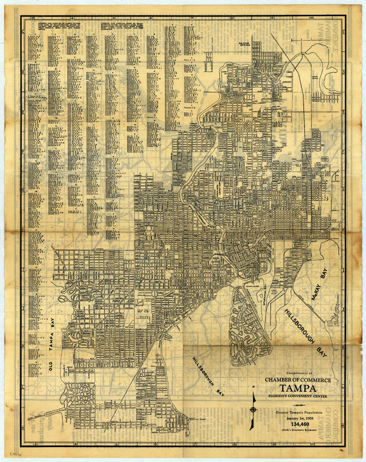
Description: Digitization provided by the USF Libraries Digitization Center. Rare Maps. This is a detailed street map of Tampa, circa 1927. This map shows roads, railroads, cities and towns, locations and inland waters. Section Township Range (STR) is shown. This map features a list of all of the streets and avenues.
Source: Hillsborough County Engineering Department, (Tampa, FL: Tampa Chamber of Commerce, 1927)
Map Credit: Courtesy of the Special Collections Department, University of South Florida.
SearchLicensePDF HelpGIS Help Google Earth Help Zoomify Help

 FL Maps > Local > Hillsborough > Tampa: Florida's Convenient Center, 1927