Title: Nassau River
Projection: Mercator,
Source Bounding Coordinates:
W: E: N: S: |
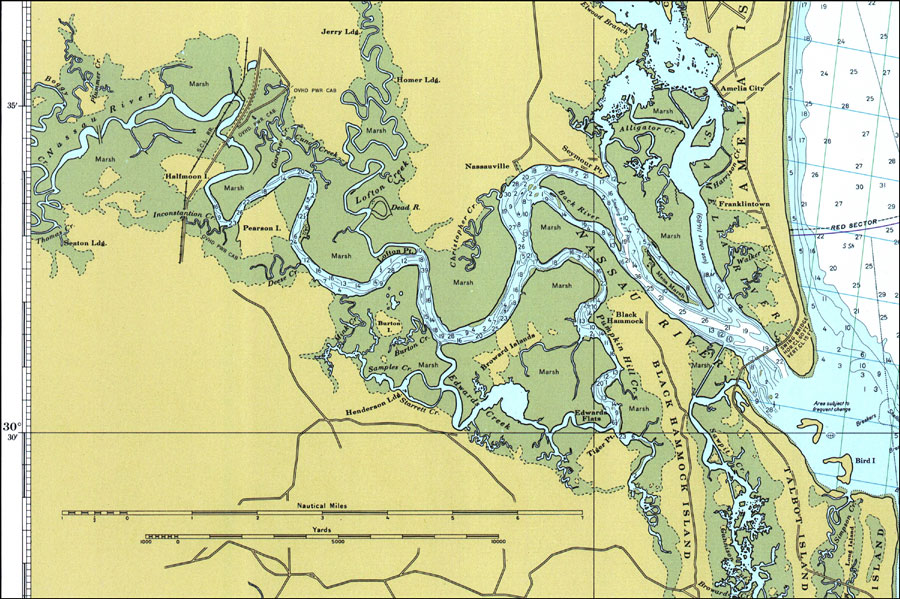
| | Description: A National Oceanic and Atmospheric Administration map of Nassau River current to 1977. This Department of Commerce chart shows all soundings expressed in feet at mean low water. Obstructions to navigation such as shoals, submerged piles, wreckages and fixed bridges are shown. The map scale is 1:80,000. North American Datum of 1927 is used. Map is LORAN-C overprinted. Key to NOAA maps.
Source: National Oceanic and Atmospheric Administration, Amelia Island to St. Augustine (Washington, D.C.: U.S. Department of Commerce, 1977)
Map Credit: Courtesy the U.S. National Oceanic and Atmospheric Administration |
| |
|