mapsExploring Florida
 FL Maps > State > 1820-1839 > Geographisch-statistische und historische Charte von Florida, 1828
Site Map 

Geographisch-statistische und historische Charte von Florida, 1828


Puzzle Directions: Click on a puzzle piece and drag it where you want it. When you connect two pieces correctly, they will join together. Mix up the pieces again. View finished map in pop-up window.

Title: Geographisch-statistische und historische Charte von Florida
Projection: Unknown
Source Bounding Coordinates:
W: -87.5 E: -79.5 N: 32 S: 24

Back to Map Page
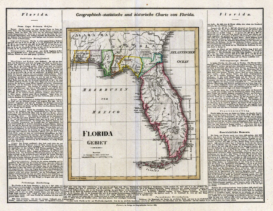
Description: Digitization provided by the USF Libraries Digitization Center. Rare Maps. This is a detailed map from Germany of Florida, circa 1828. This map shows railroads, counties, cities and towns and inland waters. The text around the map gives geographical, statistical and historical information about Florida. Measurements.Dimensions: 37 x 35 cm., on sheet 52 x 63 cm
Source: Geographisches Institut, (Weimar, : Verlag des Geographischen Instituts, 1828)
Map Credit: Courtesy of the Special Collections Department, University of South Florida.
SearchLicensePDF HelpGIS Help Google Earth Help Zoomify Help

 FL Maps > State > 1820-1839 > Geographisch-statistische und historische Charte von Florida, 1828