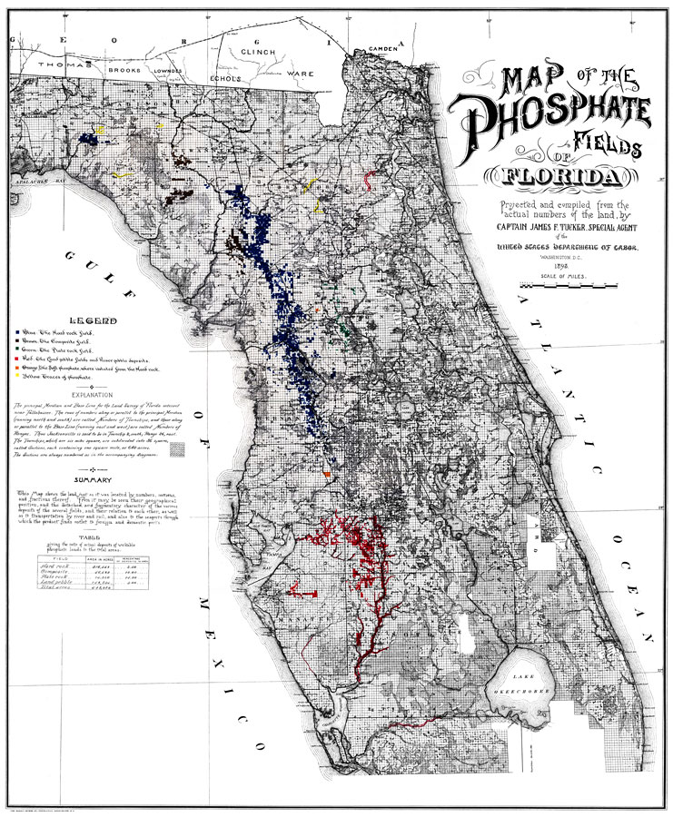
Description: Digitization provided by the USF Libraries Digitization Center. Rare Maps. This is a map of Florida showing its phosphate fields projected and compiled from the actual numbers of the land, circa 1893. The map features text, keys and tables. It shows the geographical position and characteristics of the deposits as well as cities, towns, inland waters and railroads. According to the USF library, the discovery of hard rock phosphate in Alachua County in 1889 sparked the appearance of boomtowns wherever large deposits of the mineral were found. Measurements.Dimensions: mounted on linen; 70 x 58 cm., on sheet 74 x 61 cm. Measurements.Resolution: Scale [ca. 1:78,000]
Place Names: 1880-1899, Gulf of Mexico, Atlantic Ocean, St. Petersburg, Tallahassee, Saint Augustine, Jacksonville, Gainesville, Daytona Beach, Tampa, Sarasota, Cape Canaveral
ISO Topic Categories: inlandWaters, oceans, boundaries, economy, environment, transportation
Keywords: Map of the Phosphate Fields of Florida, transportation, historical, physical, political, statistical, county borders, industry, economic, railroads, inlandWaters, oceans, boundaries, economy, environment, transportation, Unknown,1893
Source: James F. Tucker, (Washington, D. C.: Norris Peters Co., 1893)
Map Credit: Courtesy of the Special Collections Department, University of South Florida. |
|