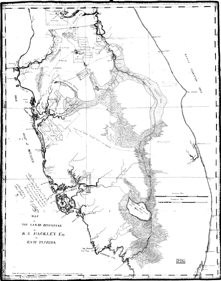
Title: Map of the Lands Belonging to R.S. Hackley, esq., in East Florida
Projection: Unknown
Source Bounding Coordinates:
W: -83 E: -80 N: 29.5 S: 25.5 |
| | Description: Digitization provided by the USF Libraries Digitization Center. Rare Maps. This is a manuscript map of the lands belonging to R. S. Hackley Esq. in east Florida covering all of Florida between Micanopy in north and Key Biscayne Bay in south, circa 1823. Section Township Range (STR) is shown. This map shows roads, cities and towns, location of land and ownership and inland waters. At lower left is probable reference to 1823 Map of Florida by Charles Vignoles. Measurements.Dimensions: 81 x 65 cm. Measurements.Resolution: Scale [ca. 1:525,000]
Source: Richard S. Hackley and Charles Blacker Vignoles, (, : , 1823)
Map Credit: Courtesy of the Special Collections Department, University of South Florida. |
| |
|