mapsExploring Florida
 FL Maps > Local > Hillsborough > A Plan of the Entrances of Tampa Bay on the West Coast of East Florida, 1770 AD
Site Map 

A Plan of the Entrances of Tampa Bay on the West Coast of East Florida, 1770 AD


Puzzle Directions: Click on a puzzle piece and drag it where you want it. When you connect two pieces correctly, they will join together. Mix up the pieces again. View finished map in pop-up window.

Title: A Plan of the Entrances of Tampa Bay on the West Coast of East Florida
Projection: Unknown
Source Bounding Coordinates:
W: E: N: S:

Back to Map Page
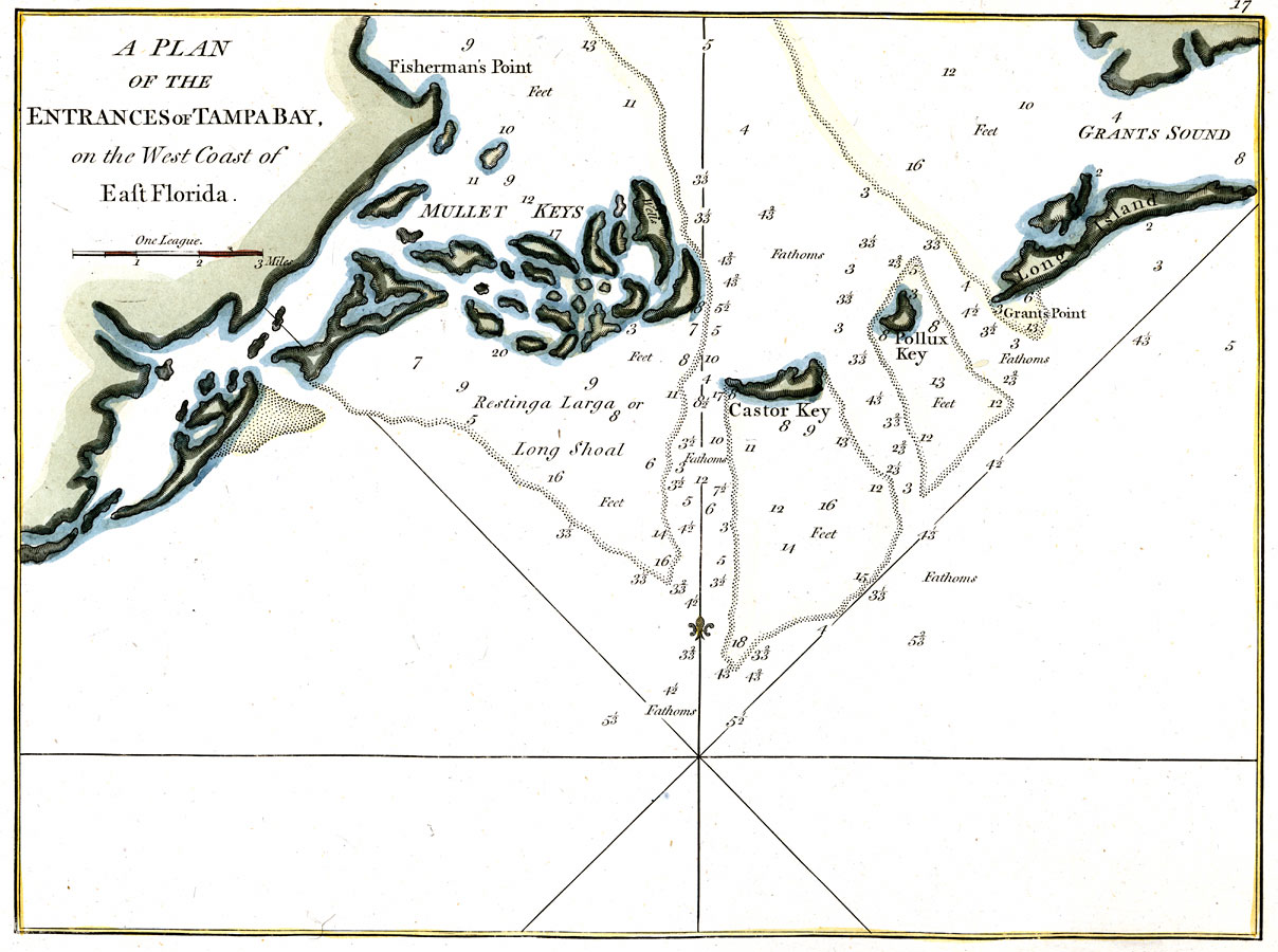
Description: Digitization provided by the USF Libraries Digitization Center. Rare Maps. This is a map of the plan of entrances of Tampa Bay while it was a part of East Florida, circa 1770. It shows water depths in fathoms, islands, keys and inland waters. Measurements.Dimensions: 32 x 24 cm. Measurements.Resolution: Scale [ca. 1:63,350]
Source: Robert Laurie and James Whittle, (London, : Robert Laurie and James Whittle, 1770)
Map Credit: Courtesy of the Special Collections Department, University of South Florida.
SearchLicensePDF HelpGIS Help Google Earth Help Zoomify Help

 FL Maps > Local > Hillsborough > A Plan of the Entrances of Tampa Bay on the West Coast of East Florida, 1770 AD