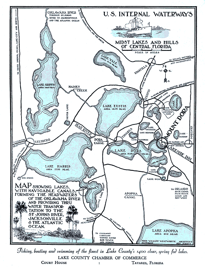
Title: U. S. internal waterways, midst lakes and hills of Central Florida
Projection: Unknown
Source Bounding Coordinates:
W: E: N: S: |
| | Description: Digitization provided by the USF Libraries Digitization Center. Rare Maps. This is a map showing of internal waterways in Lake County in central Florida, circa 1925. The map states, "Map showing lakes with navigable canals, forming the headwaters of the Oklawaha River and providing thru water transportation to the St. Johns River, Jacksonville & the Atlantic Ocean." It also says, "Fishing, boating and swimming of the finest in Lake County's 1400 clear, spring fed lakes." The map also shows cities. Measurements.Dimensions: 21.5 x 28 cm. Measurements.Resolution: Scale [ca. 1:55,750].
Source: Lake County Chamber of Commerce, (Tavares, FL: Lake County Chamber of Commerce, 1925)
Map Credit: Courtesy of the Special Collections Department, University of South Florida. |
| |
| FL Maps > County > Lake > U. S. internal waterways, midst lakes and hills of Central Florida, 1925 AD | |
|