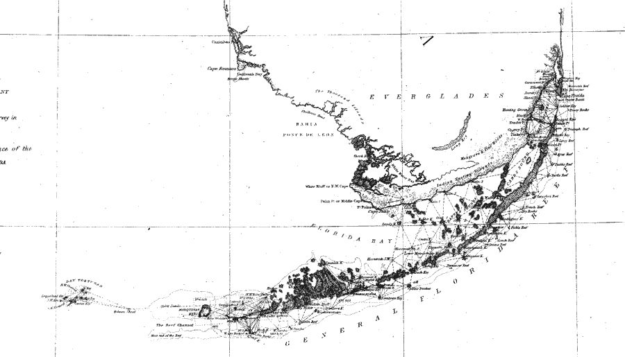
Description: A portion of a U.S. Coast Survey chart showing the southernmost point of peninsular Florida from the Miami River and Key Biscayne on the Atlantic Coast to Key West and the Dry Tortugas in the Florida Keys. The chart includes sailing directions including bearings, soundings and detailed triangulations. The map also shows the Everglades and an area of Indian hunting grounds. Included is an in-land notation describing dense forest of mangrove and pine. Surveyed by F. H. Gerdes. The map scale is 1:1,200,000.
Place Names: 1840-1859, Key Biscayne, Cape Florida, Card Sound, Key Largo, Cape Sable, Key West, Cayo Hueso, Dry Tortugas
ISO Topic Categories: transportation
Keywords: Florida Keys: A General Reconnoissance of the Western Coast of Florida, physical, transportation, physical features, water routes, transportation, Unknown,1851
Source: F.H. Gerdes, U.S. Coast Survey (Washington, DC: Government Printing Office, 1851)
Map Credit: Courtesy the private collection of Roy Winkelman |
|