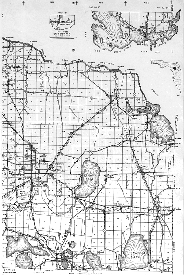
Description: This is a detailed map of the east portion of the county of Alachua in the state of Florida. Section Township Range (STR) is shown. This map shows all of the main cities, state roads, US Highways, bridge highways, railroads, location of grants, inland waters, corporate lines, county boundary, cemeteries, churches, farm units, dwellings other than farms, tenant houses, businesses, townhall, hotels, schools, hospitals, factories, sawmills, turpentine stills, post offices, seasonal dwellings, radio station, golf courses, airports, tourist camp, and municipal park. Key to Florida Highway maps.
Place Names: Alachua, La Crosse, Santa Fe River, Louise, Orange Lake, Waldo, Earlton, Lake Santa Fe, Earlton Beach, Monteocha, Paradise, Fairbanks, Gainesville, Orange Heights, Newnans Lake, Melrose, Campville, Windsor, Hawthorne, Grove Park, Phifer, Rochelle, Cannon, Levy Grant, Wacahoota, Kirkwood, Ascot, Micanopy, Lochloosa
ISO Topic Categories: boundaries, transportation, location, inlandWaters
Keywords: East Alachua, physical, political, transportation, physical features, county borders, local jurisdictions, roads, railroads, boundaries, transportation, location, inlandWaters, Unknown,1936
Source: , Florida State Road Department (Tallahassee, FL: FDOT, 1936)
Map Credit: Courtesy the private collection of Roy Winkelman. |
|