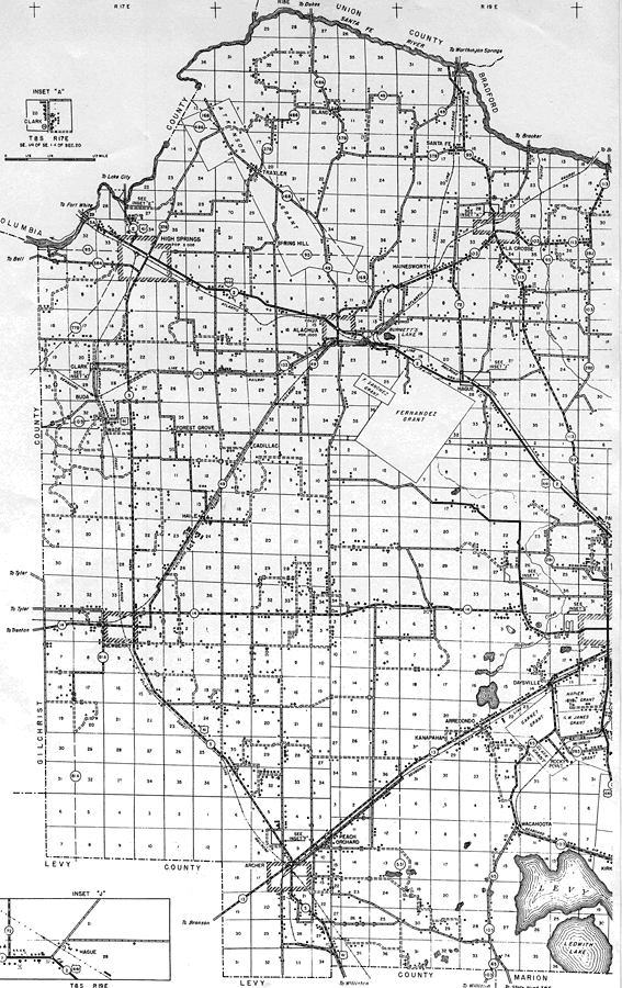
Description: This is a detailed map of the west portion of the county of Alachua in the state of Florida. Section Township Range (STR) is shown. This map shows all of the main cities, state roads, US Highways, bridge highways, railroads, location of grants, inland waters, corporate lines, county boundary, cemeteries, churches, farm units, dwellings other than farms, tenant houses, businesses, schools, airport, sawmills, turpentine stills, tourist and recreation camps. Key to Florida Highway maps.
Place Names: Alachua, Traxler, High Springs, Spring Hill, Bland, Santa Fe, La Crosse, Santa Fe River, Hainesworth, Fernandez Grant, Burnett's Lake, Alachua, Clark, Buda, Wade, Forest Grove, Cadillac, Haile, Hague, Newberry, Daysville, Arredondo, Kanapaha, Wacahoota, Rocky Point, Peach Orchard, Archer, Arrendondo
ISO Topic Categories: boundaries, transportation, location, inlandWaters
Keywords: West Alachua, physical, political, transportation, physical features, county borders, local jurisdictions, roads, railroads, boundaries, transportation, location, inlandWaters, Unknown,1936
Source: , Florida State Road Department (Tallahassee, FL: FDOT, 1936)
Map Credit: Courtesy the private collection of Roy Winkelman. |
|