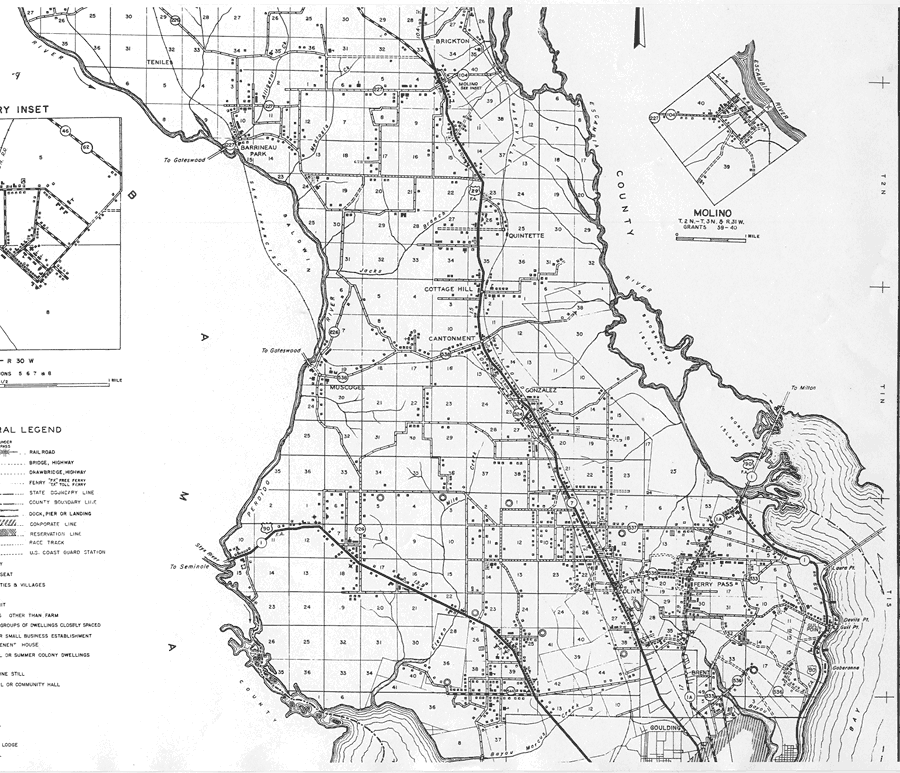
Description: This is a detailed map of the middle part of the county of Escambia in the state of Florida. Section Township Range (STR) is shown. This map shows all of the main cities, state roads, US Highways, bridge highways, federal aided highway, saw mills, railroads, inland waters, ferries, corporate lines, county boundary, camp or lodge, post offices, turpentine still, cemeteries, churches, farm units, dwellings other than farms, tenant houses, businesses, schools, and racetrack. Key to Florida Highway maps.
Place Names: Escambia, Tenile, Barrineau Park, Brickton, Quintette, Escambia River, Cottage Hill, Cantonment, Gonzalez, Muscogee, Perdido River, Ferry Pass, Gull Point, Brent, Goulding, Olive
ISO Topic Categories: inlandWaters, boundaries, transportation, location
Keywords: Mid Escambia 1, physical, political, transportation, physical features, county borders, local jurisdictions, roads, railroads, inlandWaters, boundaries, transportation, location, Unknown,1936
Source: , Florida State Road Department (Tallahassee, FL: FDOT, 1936)
Map Credit: Courtesy the private collection of Roy Winkelman. |
|