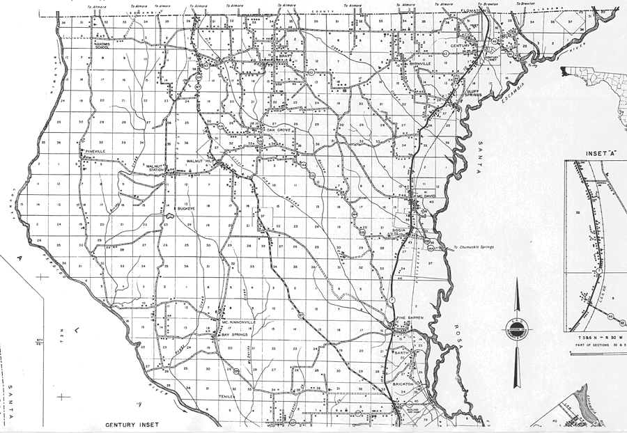
Description: This is a detailed map of the north part of the county of Escambia in the state of Florida. Section Township Range (STR) is shown. This map shows all of the main cities, state roads, US Highways, bridge highways, federal aided highway, county boundary, schools, churches, businesses, tenant houses, cemeteries, sawmills, post office, factories, turpentine stills, farm units, dwellings other than farms, and camps or lodges. Key to Florida Highway maps.
Place Names: Escambia, Nakomis School, Pineville, Walnut Station, Walnut Hill, Bratt, Oak Grove, Byrnville, Century, Bluff Springs, Flomaton, Escambia River, Mc David, Buckeye, Bogia, Pine Barren, Barth, Mc Kinnonville, Bay Springs, Tenile, Perdido River, Brickton, Molino
ISO Topic Categories: inlandWaters, boundaries, transportation, location
Keywords: North Escambia 1, physical, political, transportation, physical features, county borders, local jurisdictions, roads, railroads, inlandWaters, boundaries, transportation, location, Unknown,1936
Source: , Florida State Road Department (Tallahassee, FL: FDOT, 1936)
Map Credit: Courtesy the private collection of Roy Winkelman. |
|