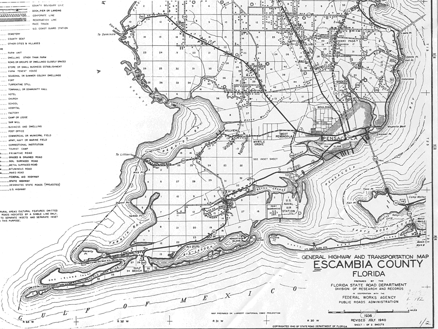
Description: This is a detailed map of the south part of the county of Escambia in the state of Florida. Section Township Range (STR) is shown. This map shows all of the main cities, state roads, US Highways, bridge highways, county boundary, county seat, schools, inland water, churches, businesses, tenant houses, cemeteries, sawmills, hotels, seasonal dwellings, factories, hospital, post office, farm units, dwellings other than farms, and camps or lodges. Key to Florida Highway maps.
Place Names: Escambia, Millview, Perdido Bay, West Pensacola, Ferry Pass, Goulding, Gull Point, Olive, Pensacola, Pensacola Bay, West Pensacola, Myrtle Grove, Fort Pickens, Fort Mc Rae
ISO Topic Categories: inlandWaters, boundaries, transportation, location
Keywords: South Escambia 1, physical, political, transportation, physical features, county borders, local jurisdictions, roads, railroads, inlandWaters, boundaries, transportation, location, Unknown,1936
Source: , Florida State Road Department (Tallahassee, FL: FDOT, 1936)
Map Credit: Courtesy the private collection of Roy Winkelman. |
|