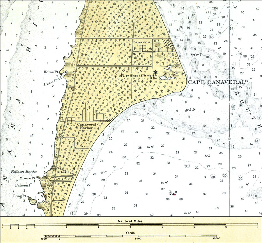
Description: A portion of the National Oceanic and Atmospheric Administration map of Cape Canaveral current to 1931. This National Ocean Survey chart shows all soundings expressed in feet. Navigational aids such as lights, beacons, and buoys are shown as well as obstructions such as shoals. The map scale is 1:80,000. N.O.A.A. map reference: 1245_9-1931. Key to NOAA maps. PLEASE NOTE: This historical data is not to be used for navigation or navigation planning. The Florida Center for Instructional Technology (FCIT) does not assume responsibility for the improper use of these data.
Place Names: Brevard, Cape Canaveral, Banana River, Canaveral Harbor, Artesia
ISO Topic Categories: inlandWaters, oceans, transportation
Keywords: Cape Canaveral, physical, transportation, hydrological, physical features, railroads, water routes, roads, water depths, inlandWaters, oceans, transportation, Unknown,1931
Source: National Oceanic and Atmospheric Administration, East Coast Survey (Washington, DC: National Oceanic and Atmospheric Administration, 1931)
Map Credit: Courtesy the U.S. National Oceanic and Atmospheric Administration |
|