Title: Lighthouse Point Detail
Projection: Transverse_Mercator,
Source Bounding Coordinates:
W: E: N: S: |
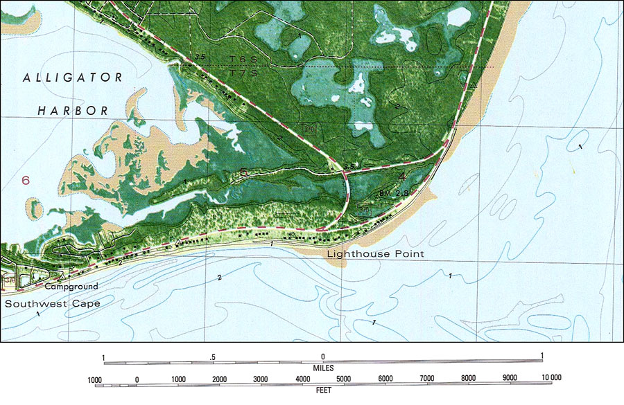
| | Description: A US Geological Survey and National Ocean Service detail map of Lighthouse Point, current to 1982. The map shows both topographic and bathymetric features. Topographic contour lines are shown at 2-meter intervals with supplemental contour intervals at 1 meter. Bathymetric contour intervals are at 1 meter with supplementary 0.5-meter contours. Bathymetric datum is mean low water. The map shows manmade structures such as local and county roads, residences, etc. Natural features include lakes, dry lands, wetlands, woodland and sand. The map scale is 1:24,000. Also shown is Section Township Range (STR) based on the Tallahassee baseline and meridian. This information is not intended for navigational purposes. The National Geodetic Vertical Datum of 1929 is used in this map. The projection used 1927 North American Datum with reference on converting to North American Datum 1983. Key to NOAA maps. PLEASE NOTE: This historical data is not to be used for navigation or navigation planning. The Florida Center for Instructional Technology (FCIT) does not assume responsibility for the improper use of these data.
Source: U. S. Coast and Geodetic Survey and National Ocean Service, Lighthouse Point Quadrangle (Reston, VA: United States Geological Survey, 1982)
Map Credit: Courtesy the U.S. National Oceanic and Atmospheric Administration |
| |
|