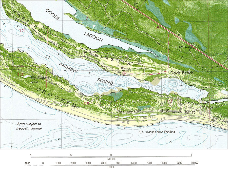
Description: A US Geological Survey and National Ocean Service map of St. Andrew Point, current to 1982. The map shows both topographic and bathymetric features. Topographic contour lines are shown at 2-meter intervals with supplemental contour intervals at 1 meter. Bathymetric contour intervals are at 1 meter with supplementary 0.5-meter contours. Bathymetric datum is mean lower low water. The map shows manmade structures such as primary and secondary roads, residences, etc. Natural features include drylands, woodlands, lakes, lagoons, and wetlands. Also shown is Section Township Range (STR) based on the Tallahassee baseline and meridian. The map scale is 1:24,000. This information is not intended for navigational purposes. The National Geodetic Vertical Datum of 1929 is used. The projection used 1927 North American Datum with reference on converting to North American Datum 1983. Key to NOAA maps. PLEASE NOTE: This historical data is not to be used for navigation or navigation planning. The Florida Center for Instructional Technology (FCIT) does not assume responsibility for the improper use of these data.
Place Names: Bay, St. Andrew Point, St. Andrew Sound, Saint Andrews Point, Saint Andrews Sound, Davis Beach, Wild Goose Lagoon, Hurricane Lake, Big Alligator Lake, Crooked Island, Gulf of Mexico
ISO Topic Categories: oceans, inlandWaters, transportation, elevation, location
Keywords: St. Andrew Point, physical, transportation, hydrological, physical features, topographical, roads, water depths, oceans, inlandWaters, transportation, elevation, location, Lambert_Conformal_Conic, Transverse_Mercator, 1982
Source: U. S. Coast and Geodetic Survey and National Ocean Service, Beacon Hill Quadrangle (Reston, VA: United States Geological Survey, 1982)
Map Credit: Courtesy the U.S. National Oceanic and Atmospheric Administration |
|