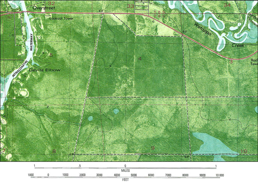
Description: A portion of the National Ocean Survey map of Overstreet current to 1982. This orthophotomap shows both topographic and bathymetric features. Topographic and bathymetric contour intervals are shown in meters. Topographic contour lines are shown at 2-meter intervals with supplemental contour intervals at 1 meter. Bathymetric contour intervals are at 1 meter with supplementary 0.5 meter contours. Bathymetric datum is mean lower low water.The map shows man made structures such as radio towers, pipelines, Intracoastal Waterway, and canals. Natural features include rivers, bayous, swamps and wetlands. The map scale is 1:24,000. The National Geodetic Vertical Datum of 1929 is used in this map. The projection used 1927 North American Datum with reference on converting to North American Datum 1983. Key to NOAA maps. PLEASE NOTE: This historical data is not to be used for navigation or navigation planning. The Florida Center for Instructional Technology (FCIT) does not assume responsibility for the improper use of these data.
Place Names: Gulf, Overstreet, Devils Elbow, Intracostal Waterway, Wetappo Creek
ISO Topic Categories: inlandWaters, transportation, elevation
Keywords: Overstreet Detail, physical, transportation, hydrological, physical features, topographical, roads, water routes, water depths, inlandWaters, transportation, elevation, Transverse_Mercator, Lambert_Conformal_Conic, 1982
Source: USGS and NOAA, Overstreet Quadrangle (Reston, VA: United States Geological Survey, 1982)
Map Credit: Courtesy the U.S. National Oceanic and Atmospheric Administration |
|