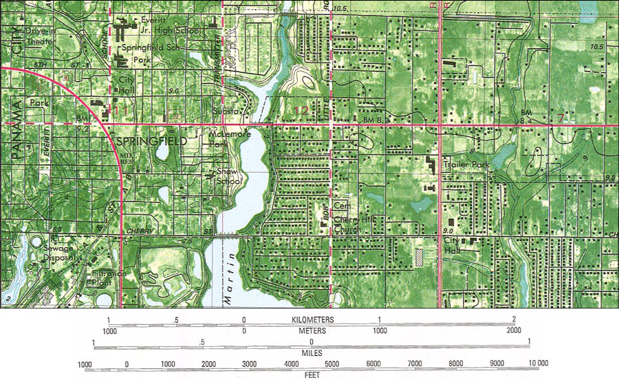
Description: A portion of the National Ocean Survey map of Springfield current to 1982 showing the city of Springfield. This orthophotomap shows both topographic and bathymetric features. Topographic and bathymetric contour intervals are shown in meters. The map shows man made structures such as primary, and secondary roads, trailer parks, drive-in theater, parks and canals as well as various buildings including residences, churches, schools, city halls, et cetera. Natural features include rivers, bayous, and wetlands. The map scale is 1:24,000. The National Geodetic Vertical Datum of 1929 is used in this map. The projection used 1927 North American Datum with reference on converting to North American Datum 1983. The Township/Range grid based on the Tallahassee baseline and meridian is shown. Key to NOAA maps. PLEASE NOTE: This historical data is not to be used for navigation or navigation planning. The Florida Center for Instructional Technology (FCIT) does not assume responsibility for the improper use of these data.
Place Names: Bay, Springfield
ISO Topic Categories: inlandWaters, transportation, elevation
Keywords: Springfield, physical, transportation, physical features, topographical, roads, water routes, water depths, water table, inlandWaters, transportation, elevation, Transverse_Mercator, 1982
Source: USGS and NOAA, Springfield Quadrangle (Reston, VA: United States Geological Survey, 1982)
Map Credit: Courtesy the U.S. National Oceanic and Atmospheric Administration |
|