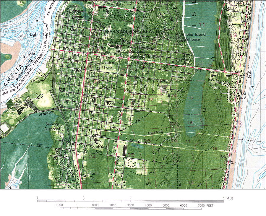
Description: A portion of the US Geological Survey and National Ocean Service map of Fernandina Beach, current to 1981 showing details of Fernandina. This orthophotomap shows both topographic and bathymetric features. Topographic and bathymetric contour intervals are shown in meters. Bathymetric datum is mean low water. The map shows man made structures such as primary and secondary roads, railroads, intracoastal waterway, lighthouse, parks, as well as various buildings including schools, churches, residences, et cetera. Natural features include rivers, wetlands and partially submerged land exposed at mean low tide. The map scale is 1:24,000. This information is not intended for navigational purposes. The National Geodetic Vertical Datum of 1929 is used in this map. The projection used 1927 North American Datum with reference on converting to North American Datum 1983. Part of Camden County, state of Georgia is included in the map. Key to NOAA maps. PLEASE NOTE: This historical data is not to be used for navigation or navigation planning. The Florida Center for Instructional Technology (FCIT) does not assume responsibility for the improper use of these data.
Place Names: Nassau, Fernandina Beach, Amelia Island, Amelia River
ISO Topic Categories: inlandWaters, oceans, transportation, elevation
Keywords: Fernandina Beach Detail, physical, transportation, hydrological, physical features, topographical, roads, railroads, water depths, inlandWaters, oceans, transportation, elevation, Transverse_Mercator, 1981
Source: USGS and NOAA, Fernandina Beach Quadrangle (Reston, VA: United States Geological Survey, 1981)
Map Credit: Courtesy the U.S. National Oceanic and Atmospheric Administration |
|