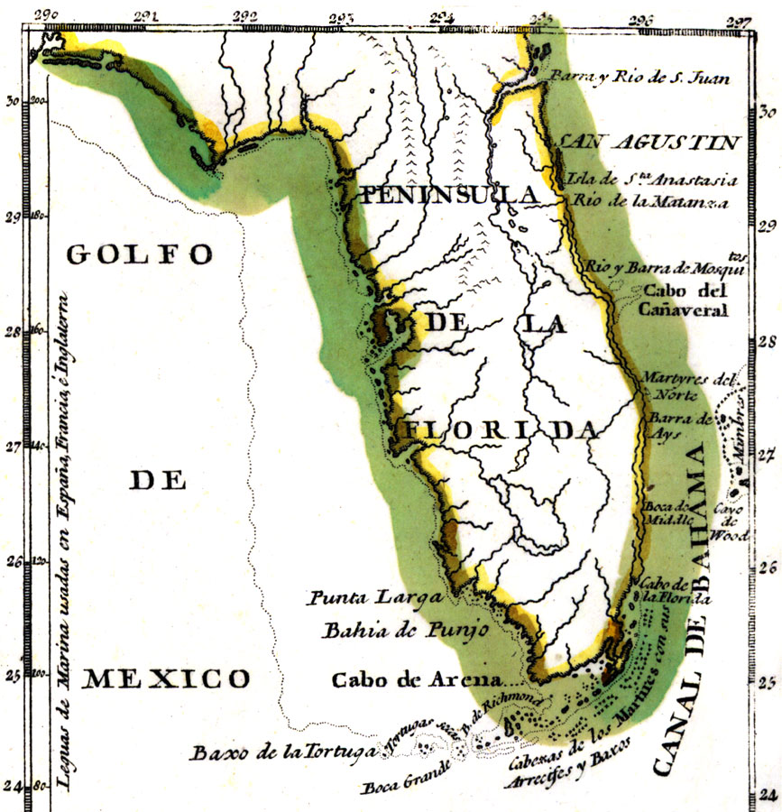
Description: Digitization provided by the USF Libraries Digitization Center. Rare Maps. This is a map of the Peninsula of Florida showing inland waters and towns in Spanish, circa 1783. It is part of an inset map from a hand colored map of the Saint Augustine region. It shows the location of Saint Augustine or San Agustin, Cape Canaveral or Cabo del Canaveral, and more. [ca. 1:7,000,000].
Place Names: 1780-1799, San Agustin, Saint Augustine, Matanzas River, Golfo de Mexico, Gulf of Mexico, Cabo del Canaveral, Cape Canaveral, Isla de Santa Anastasia, Anastasia Island, Boca Grande
ISO Topic Categories: inlandWaters, oceans
Keywords: Peninsula de la Florida, physical, historical, political, physical features, inlandWaters, oceans, Unknown,1783
Source: Don Tomas Lopez, (Madrid, : , 1783)
Map Credit: Courtesy of the Special Collections Department, University of South Florida. |
|