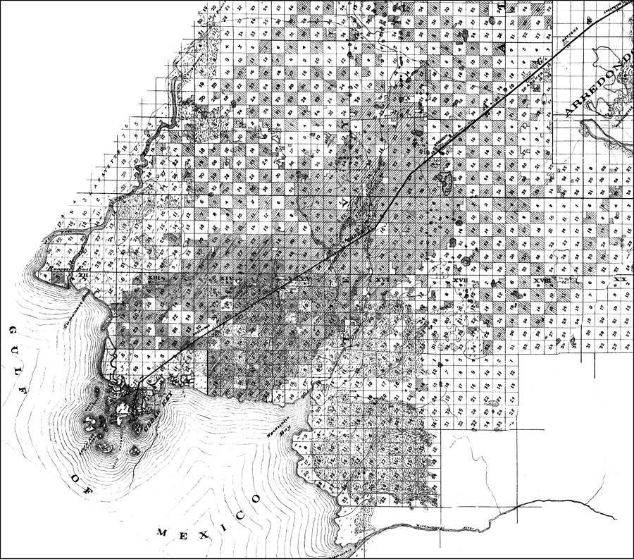
Description: A portion of Krerner's 1876 map showing land ownership by the Florida Land & Immigration and the Florida Railroad Bondholders in north-central Florida. This map covers the area of Levy County, Florida. It shows names of land-owners, inland waters, cities and towns. Section Township Range (STR) based on the Tallahassee Prime Meridian and Tallahassee Base Line is shown. Land ownership by the Florida Land & Immigration and the Florida Railroad Bondholders is differentiated. Digitization provided by the USF Libraries Digitization Center. Rare Maps. Measurement dimensions: 98 x 50.5.
Source: E.O.W Koerner, Florida Land & Immigration Company (New York, NY: American Photo Lithographic Co., 1876)
Map Credit: Courtesy of the Special Collections Department, University of South Florida. |
|