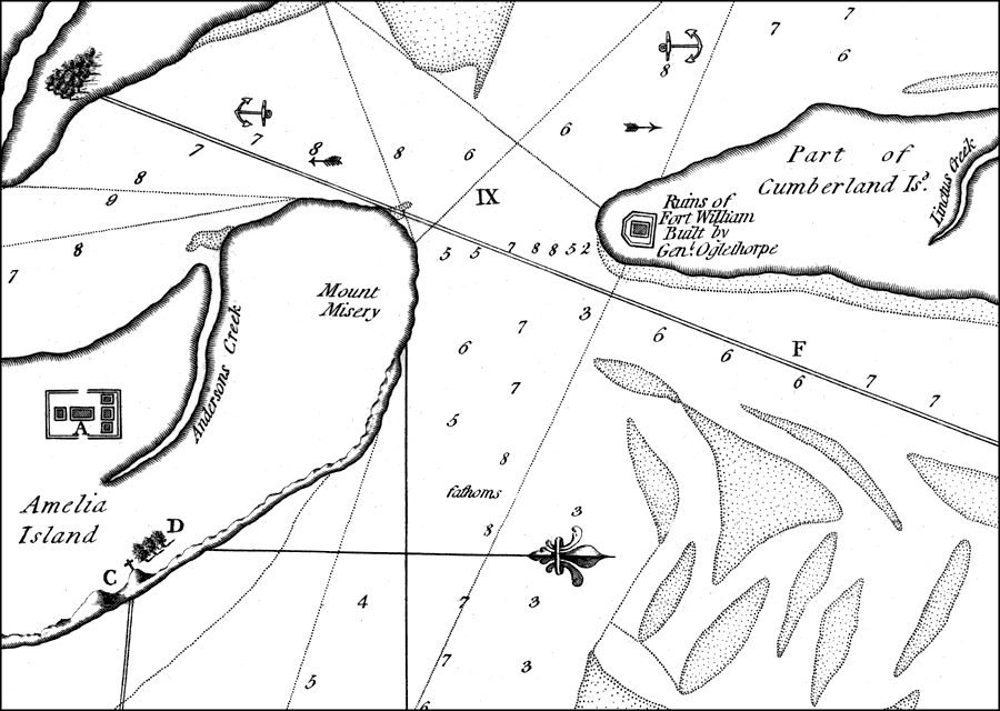
Description: A detail portion of Blamey's map of the entrance of the St. Mary's River. Digitization provided by the USF Libraries Digitization Center. Rare Maps. This is a map of the Amelia Island area showing marshes, plantations, islands, water depths and more, circa 1794. Surveyed in 1775 by Jacob Blamey, Master of His Majesty's Schooner St. John. John Perceval, Second Earl of Egmont considered the Amelia River and her naturally deep harbor to be exceptional for water transportation. Measurements.Dimensions: 59 x 40 cmMeasurements.Resolution: Scale [ca. 1:38,000]
Place Names: Nassau, Amelia Island
ISO Topic Categories: inlandWaters, oceans, transportation
Keywords: A Detail Plan of Amelia Harbour and Barr in East Florida, historical, hydrological, physical, transportation, physical features, water routes, water depths, inlandWaters, oceans, transportation, Unknown,1794
Source: Jacob Blamey, (London, : Laurie & Whittle, 1794)
Map Credit: Courtesy of the Special Collections Department, University of South Florida. |
|