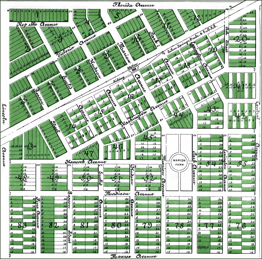
Description: A portion of the plat map of the city of Leroy, Florida detailing the town center. Digitization provided by the USF Libraries Digitization Center. Rare Maps. This is a detailed map showing the plat of the city of Leroy, circa 1890. Section Township Range (STR) is shown. All lots in green are sold and ownership is shown. Scale: 300 ft. to the inch.
Place Names: Marion, Leroy
ISO Topic Categories: transportation, location, boundaries
Keywords: Plat of the City of Leroy, Marion Co., Florida - Detail, transportation, physical, political, historical, local jurisdictions, roads, railroads, transportation, location, boundaries, Unknown,1890
Source: , (New York, NY: People's Homestead Company, 1890)
Map Credit: Courtesy of the Special Collections Department, University of South Florida. |
|