mapsExploring Florida
 FL Maps > County > Osceola > Osceola County, 1898
Site Map 

Osceola County, 1898


Puzzle Directions: Click on a puzzle piece and drag it where you want it. When you connect two pieces correctly, they will join together. Mix up the pieces again. View finished map in pop-up window.

Title: Osceola County
Projection: Unknown
Source Bounding Coordinates:
W: -81.7 E: -80.8 N: 28.4 S: 27.2

Back to Map Page
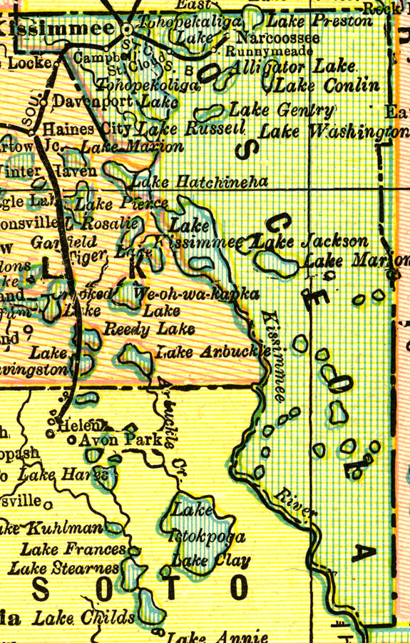
Description: A map of Osceola County as of 1898 showing rivers, lakes, railroads, towns, and the county seat, Kissimmee.
Source: George Franklin Cram, Cram's Universal Atlas: Geographical, Astronomical, and Historical (Chicago, IL: Geo. F. Cram, 1898)
Map Credit: Courtesy the private collection of Roy Winkelman.
SearchLicensePDF HelpGIS Help Google Earth Help Zoomify Help

 FL Maps > County > Osceola > Osceola County, 1898