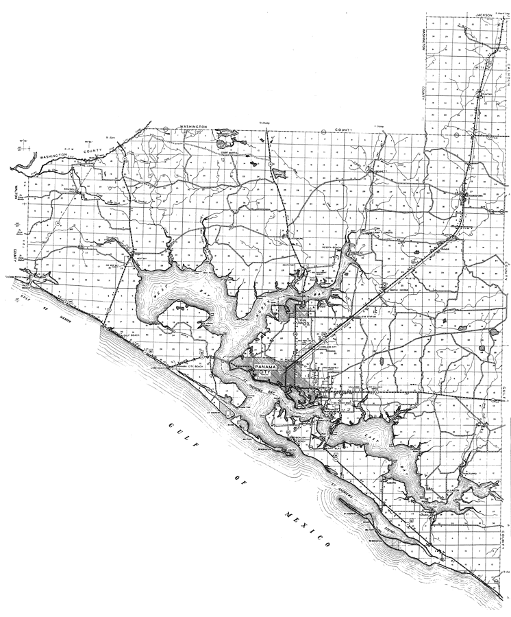
Description: This is a detailed map of the county of Bay in the state of Florida. Section Township Range (STR) is shown. This map shows all of the main cities, state roads, US Highways, bridge highways, drawbridge highways, federal aided highway, saw mills, railroads, airports, inland waters, canals, ferries, corporate lines, county boundaries, county seat, camps or lodges, post offices, forest ranger lookout stations, turpentine stills, cemeteries, churches, farm units, dwellings other than farms, tenant houses, businesses, townhalls, hotels, schools, hospitals and factories. Key to Florida Highway maps.
Place Names: Bay, Seminole Hills, West Bay, Otter Creek, Court Martial, Court Marial Lake, Lake Merial, Bennett, Camp Flowers, Resota Beach, Vicksburg, Nixon, Gainer, Youngstown, Betts, Bayou George, Lynn Haven, North Bay, Deer Point, Southport, Inlet Beach, Phillips Inlet, Long Beach, Panama City Beach, Panama City, Highland City, Parker, Cromanton, St. Andrews Bay, St. Andrews Sound, Beacon Beach, Cook, San Blas, Farmdale, Allanton, Wetappo, Auburn, Crooked Island, Gulf of Mexico, Davis Beach, Pinelog, Gulf Beach, Fountain, Saint Andrews Bay, Majette, Bay Head, East Bay
ISO Topic Categories: boundaries, inlandWaters, location, oceans, transportation
Keywords: Bay, physical, political, transportation, physical features, major political subdivisions, county borders, local jurisdictions, roads, railroads, boundaries, inlandWaters, location, oceans, transportation, Unknown,1936
Source: , Florida State Road Department (, FL: , 1936)
Map Credit: Courtesy the private collection of Roy Winkelman. |
|