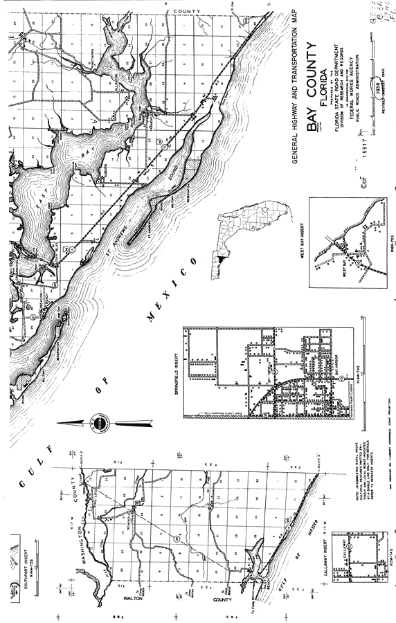
Description: This is a detailed map of the south portion of the county of Bay in the state of Florida. Section Township Range (STR) is shown. This map shows all of the main cities, state roads, US Highways, bridge highways, federal aided highway, railroads, inland waters, canals, ferries, corporate lines, county boundaries, townhall, forest ranger lookout stations, turpentine stills, cemeteries, camps, churches, saw mills, farm units, dwellings other than farms, businesses, hotels, seasonal dwellings, schools and factories. Key to Florida Highway maps.
Place Names: Bay, Pinelog, Seminole Hills, St. Andrews Sound, San Blas, Cromanton, Beacon Beach, East Bay, Allanton, Farmdale, Auburn, Wetappo, Crooked Island, Davis Beach, Gulf of Mexico
ISO Topic Categories: boundaries, location, transportation, inlandWaters, oceans
Keywords: South Bay, physical, political, transportation, physical features, major political subdivisions, county borders, local jurisdictions, roads, railroads, boundaries, location, transportation, inlandWaters, oceans, Unknown,1936
Source: , Florida State Road Department (, FL: , 1936)
Map Credit: Courtesy the private collection of Roy Winkelman. |
|