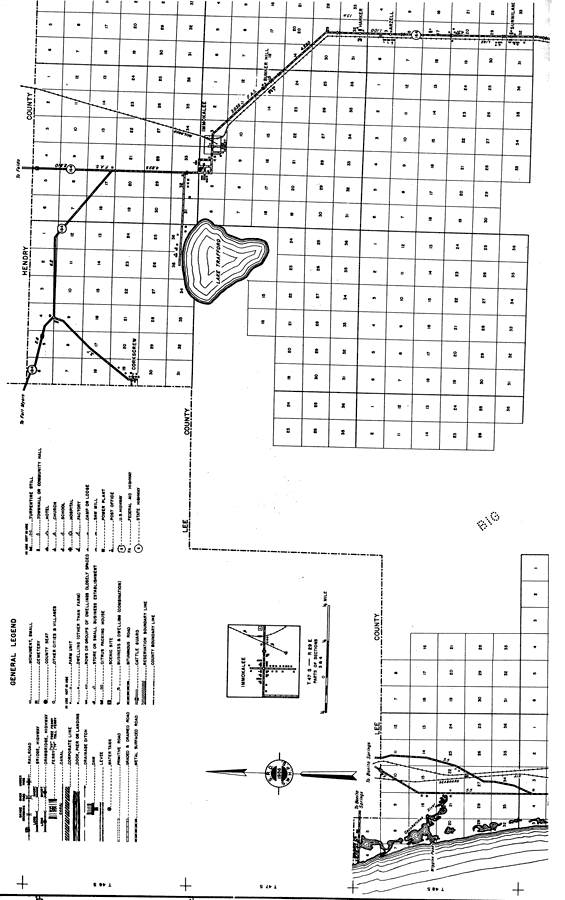
Description: This is a detailed map of the north portion of the county of Collier in the state of Florida. Section Township Range (STR) is shown. This map shows all of the main cities, state roads, bridge highways, drawbridge highways, federal aided highway, saw mills, railroads, inland waters, corporate lines, county boundaries, farm units, dwellings other than farms, businesses and schools. Key to Florida Highway maps.
Place Names: Collier, Corkscrew, Immokalee, Lake Trafford, Bunker Hill, Harker, Arzell, Sunniland, Wiggins Pass, Cocohatchee River, Big Cypress Swamp, Gulf of Mexico
ISO Topic Categories: boundaries, location, transportation, inlandWaters, oceans
Keywords: North Collier, physical, political, transportation, physical features, major political subdivisions, county borders, local jurisdictions, roads, railroads, boundaries, location, transportation, inlandWaters, oceans, Unknown,1936
Source: , Florida State Road Department (, FL: , 1936)
Map Credit: Courtesy the private collection of Roy Winkelman. |
|