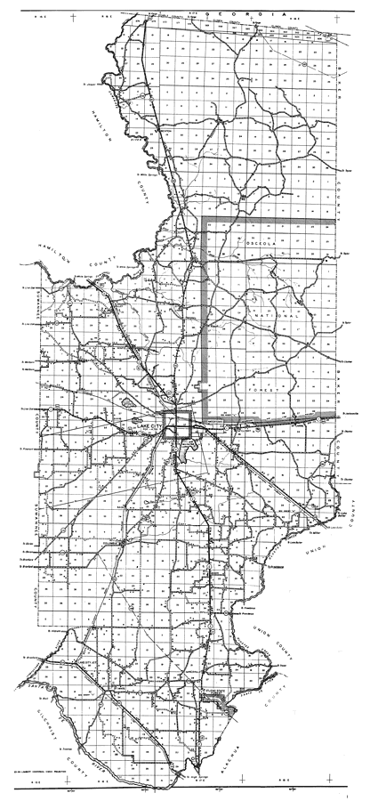
Description: This is a detailed map of the county of Columbia in the state of Florida. Section Township Range (STR) is shown. This map shows all of the main cities, state roads, US Highways, bridge highways, drawbridge highways, federal aided highway, saw mills, railroads, inland waters, canals, ferries, corporate lines, county boundaries, county seat, camps or lodges, post offices, turpentine stills, cemeteries, churches, farm units, dwellings other than farms, tenant houses, businesses, townhalls, hotels, airports, schools, hospitals and factories. Key to Florida Highway maps.
Place Names: Columbia, Suwannee River, Benton, Osceola National Forest, Deep Creek, Suwannee Valley, Winfield, Lake Jeffrie, Big Alligator Lake, Lake City, Watertown, Mt. Carrie, McClosky, Lulu, Columbia, Bass, Mason, Ellisville, Olustee Creek, Santa Fe River, Ft. White, Oleno State Forest, Mikesville, Fort White
ISO Topic Categories: location, boundaries, transportation, inlandWaters
Keywords: Columbia, physical, political, transportation, physical features, major political subdivisions, county borders, local jurisdictions, roads, railroads, location, boundaries, transportation, inlandWaters, Unknown,1936
Source: , Florida State Road Department (, FL: , 1936)
Map Credit: Courtesy the private collection of Roy Winkelman. |
|