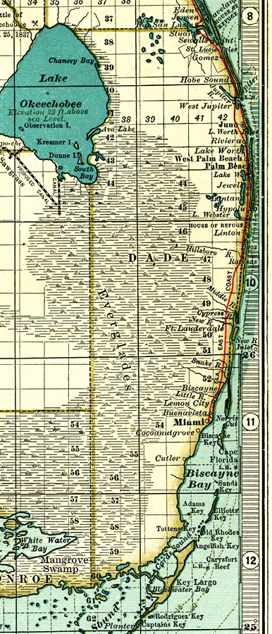
Description: A map of Dade County showing forts, towns, bodies of water, county lines, the county seat (Juno), and railroads connecting the major cities current to 1897. Township and Range grids extending from the Tallahassee Meridian and Tallahassee Base Line are shown. House of Refuge rescue stations.
Place Names: Dade, Juno, Lake Worth, Jewell, Hypolux, Boca Raton, Lemon City, Miami, Key Biscayne, Cutler
ISO Topic Categories: boundaries, oceans, inlandWaters, transportation
Keywords: Dade County, physical, political, transportation, physical features, county borders, railroads, boundaries, oceans, inlandWaters, transportation, Unknown,1897
Source: , The Century Atlas (New York, NY: The Century Co., 1897) 39
Map Credit: Courtesy the private collection of Roy Winkelman. |
|