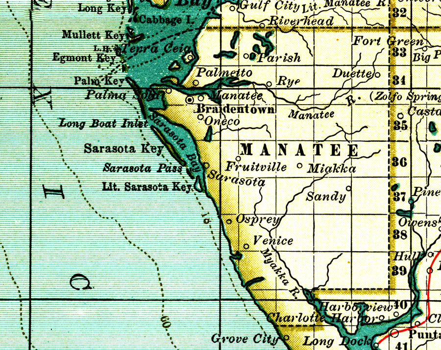
Description: A map of Manatee County showing forts, major cities, towns, bodies of water, county lines, the county seat (Braidentown/Bradenton) current to 1897. Township and Range grids extending from the Tallahassee Meridian and Tallahassee Base Line are shown.
Place Names: Manatee, Parish, Palmetto, Rye, Myakka City, Miakka, Sarasota, Oneco, Bradenton, Braidentown, Manatee
ISO Topic Categories: boundaries, inlandWaters, oceans
Keywords: Manatee County, physical, political, physical features, county borders, boundaries, inlandWaters, oceans, Unknown,1897
Source: , The Century Atlas (New York, NY: The Century Co., 1897) 39
Map Credit: Courtesy the private collection of Roy Winkelman. |
|