mapsExploring Florida
 FL Maps > County > Manatee > Manatee County, 1897
Site Map 

Manatee County, 1897


Puzzle Directions: Click on a puzzle piece and drag it where you want it. When you connect two pieces correctly, they will join together. Mix up the pieces again. View finished map in pop-up window.

Title: Manatee County
Projection: Unknown
Source Bounding Coordinates:
W: E: N: S:

Back to Map Page
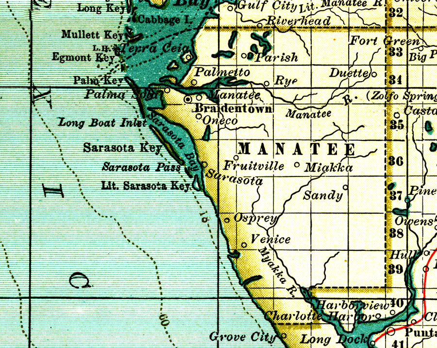
Description: A map of Manatee County showing forts, major cities, towns, bodies of water, county lines, the county seat (Braidentown/Bradenton) current to 1897. Township and Range grids extending from the Tallahassee Meridian and Tallahassee Base Line are shown.
Source: , The Century Atlas (New York, NY: The Century Co., 1897) 39
Map Credit: Courtesy the private collection of Roy Winkelman.
SearchLicensePDF HelpGIS Help Google Earth Help Zoomify Help

 FL Maps > County > Manatee > Manatee County, 1897