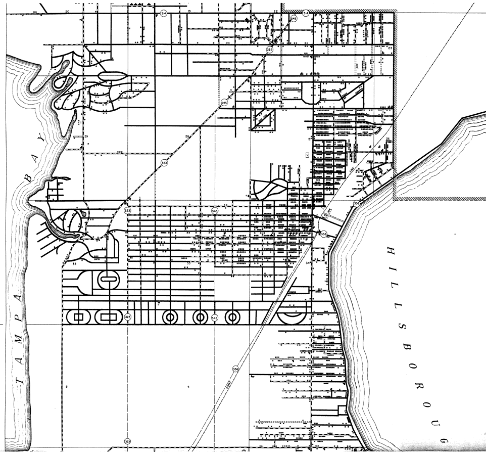
Description: This is a detailed map of the north part of South Tampa in Hillsborough County, Florida. Section Township Range (STR) is shown. This map shows all of the main cities, state roads, bridge highways, railroads, inland waters, corporate lines, dwellings other than farms, hotels, businesses, camps and schools. Key to Florida Highway maps.
Place Names: Hillsborough, Tampa, Tampa Bay, Hillsborough Bay
ISO Topic Categories: boundaries, location, transportation, inlandWaters
Keywords: North South Tampa, physical, political, transportation, physical features, major political subdivisions, county borders, local jurisdictions, roads, railroads, boundaries, location, transportation, inlandWaters, Unknown,1936
Source: , Florida State Road Department (, FL: , 1936)
Map Credit: Courtesy the private collection of Roy Winkelman. |
|