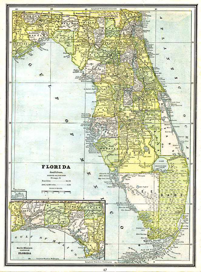
Description: A map of Florida showing county lines current to 1890, including each county seat and major towns. The railroad system extends as far south as Punta Gorda (Charlotte Harbor) on the Gulf Coast, and Titusville on the Atlantic Coast. Major rivers and wetlands are shown as well as the Florida Keys and barrier islands. Longitude is shown as west from Greenwich at the top of the map, and Longitude west of Washington at the bottom. Existing drainage canals are shown to the southwest of Lake Okeechobee and a proposed canal to the northeast. The western panhandle (approximately west of the Apalachicola River) is shown on an inset map.
Source: George F. Cram, (Chicago, IL: Geo. F. Cram, 1890) 47
Map Credit: Courtesy the private collection of Roy Winkelman. |
|