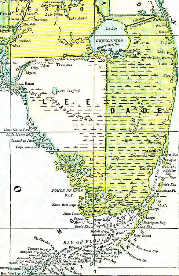
Description: A map of the southern tip of peninsular Florida showing Lake Okeechobee, the Big Cypress Swamp, the Big Sawgrass Swamp, and the Everglades. Existing drainage canals are shown to the southwest of Lake Okeechobee and a proposed canal to the northeast, before the large Everglades drainage projects were started to the southeast of the lake. The center of the Everglades is marked ŇUnsurveyedÓ. The railroad to Miami was not completed when this map was drawn.
Source: George F. Cram, (Chicago, IL: Geo. F. Cram, 1890) 47
Map Credit: Courtesy the private collection of Roy Winkelman. |
|