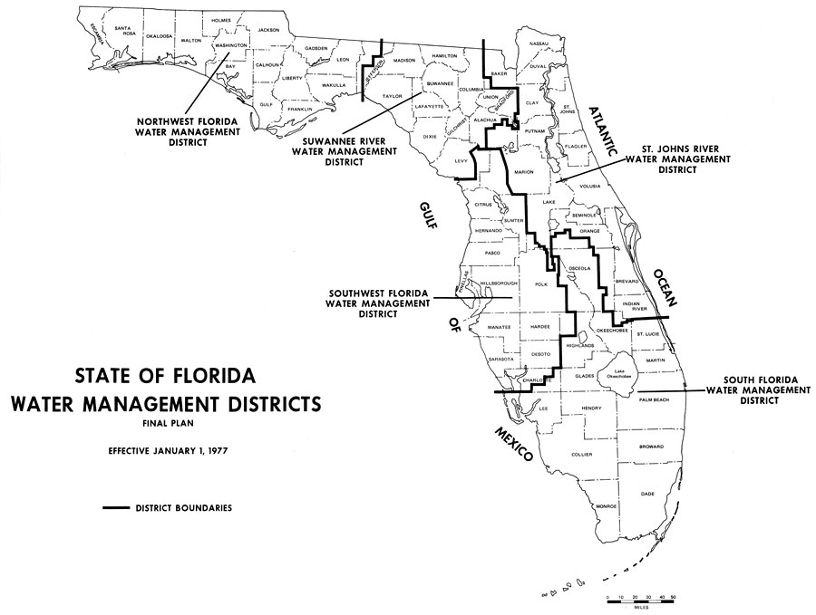
Description: This is a map showing the water management districts in Florida, effective on January 1, 1977. They include Northwest Florida, Suwannee River, St. Johns River, Southwest Florida and South Florida. The bold line shows the district boundaries.
Place Names: 1950-1999, Counties, Hillsborough, Gulf of Mexico, Lake Okeechobee, Orange, St. Johns River, Suwannee River
ISO Topic Categories: boundaries, inlandWaters, oceans
Keywords: State of Florida Water Management Districts, physical, hydrological, water districts, boundaries, inlandWaters, oceans, Unknown,1977
Source: U. S. Geological Survey, Bureau of Geology, Florida Department of Natural Resources , Florida Water Atlas (Tallahassee, FL: Bureau of Geology, 1976)
Map Credit: Courtesy the University of South Florida Library |
|