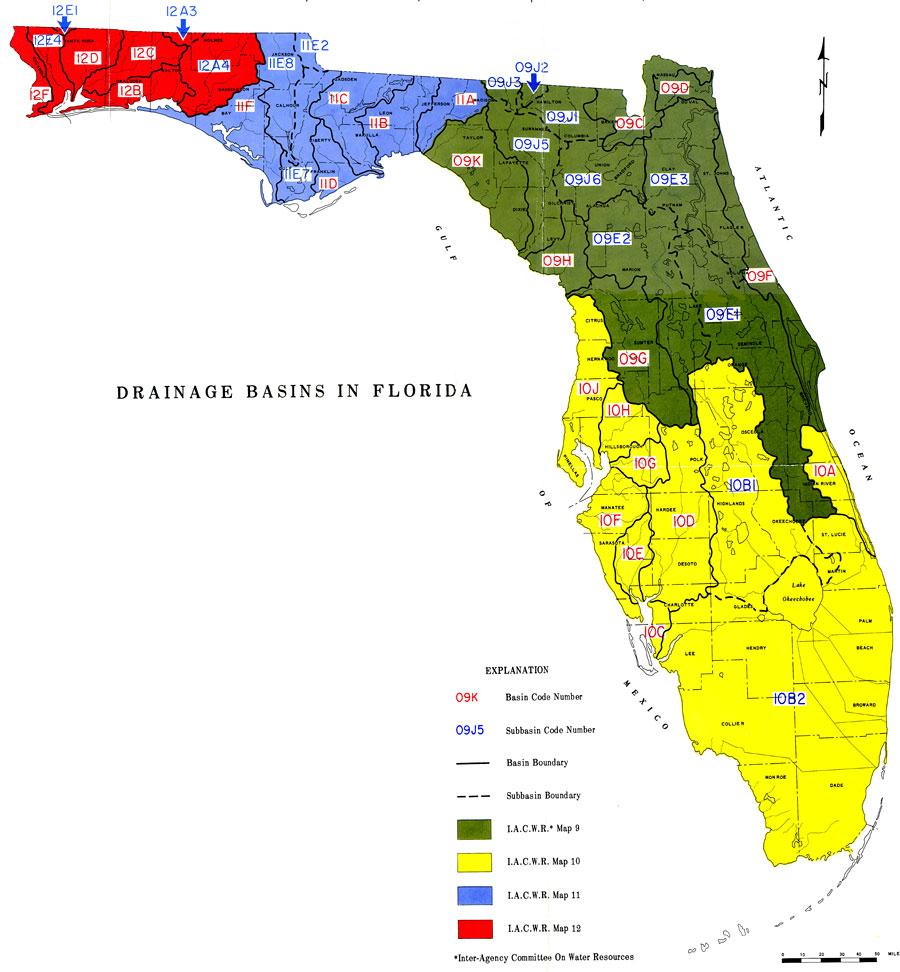
Description: This is a map showing the drainage basins in Florida, current to 1967. The different areas are color coded with green being I. A. C. W. R. or Inter-Agency Committee on Water Resources Map 9, yellow I. A. C. W. R. Map 10, blue I. A. C. W. R. Map 11 and red I. A. C. W. R. Map 12. The basin and Subbasin code numbers start with the I. A. C. W. R. Map number. The basin numbers are in red and the subbasin numbers are in blue. For example, the St. Mary's River Basin and coastal area is 09C. Please see the article Drainage Basins in Florida by W. E. Kenner, R. W. Pride and C. S. Conover for more information.
Place Names: 1950-1999, Counties, Hillsborough, Atlantic Ocean, Gulf of Mexico, Lake Okeechobee, Orange, St. Johns River, Suwannee River
ISO Topic Categories: boundaries, inlandWaters, oceans, environment, geoscientificInformation
Keywords: Drainage Basins in Florida, physical, hydrological, drainage basins, khydrological, drainage basins, boundaries, inlandWaters, oceans, environment, geoscientificInformation, Unknown,1967
Source: U. S. Geological Survey, Bureau of Geology, Florida Department of Natural Resources , Florida Water Atlas (Tallahassee, FL: Bureau of Geology, 1976)
Map Credit: Courtesy the University of South Florida Library |
|