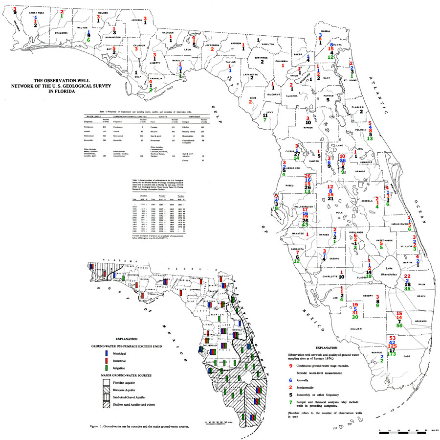
Description: This is a map of Florida showing the observation well network of the U. S. Geological Survey, current to 1975. The following is taken from the article "The Observation-Well Network of the U. S. Geological Survey in Florida" by Henry G. Healy — "An observation-well network has been established throughout Florida to evaluate the status of ground water resources in each aquifer." As shown in the key, the red numbers represent continuous ground water stage recorders, the blue represents annual water level measurement, the orange shows semiannual, the black is bimonthly or other frequency and the green numbers are sample and chemical analyses which may include wells in the preceding categories. Please see the article The Observation-Well Network of the U. S. Geological Survey in Florida by Henry G. Healy for more information.
Place Names: 1950-1999, Counties, Hillsborough, Atlantic Ocean, Gulf of Mexico, Lake Okeechobee, Orange, St. Johns River, Suwannee River
ISO Topic Categories: boundaries, inlandWaters, oceans, environment
Keywords: Observation Well Network, hydrological, physical, wells, boundaries, inlandWaters, oceans, environment, Unknown,1974
Source: U. S. Geological Survey, Bureau of Geology, Florida Department of Natural Resources , Florida Water Atlas (Tallahassee, FL: Bureau of Geology, 1976)
Map Credit: Courtesy the University of South Florida Library |
|