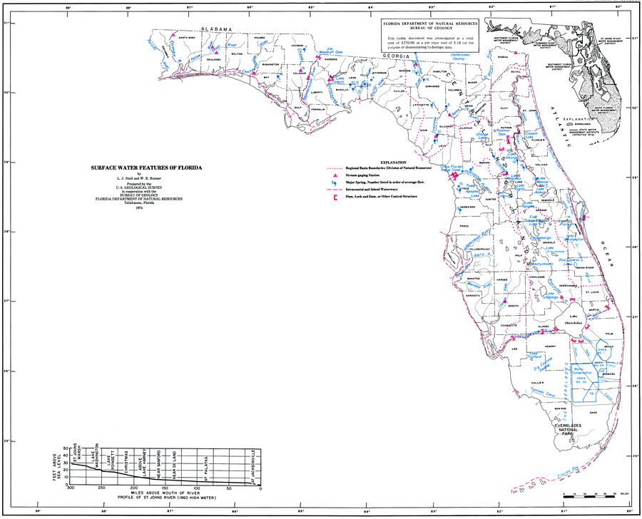
Description: This is a map showing the surface water features in Florida, current to 1974. The following is taken from the article "Surface Water Features of Florida" by L. J. Snell and W. E. Kenner — "The variety of surface water features of Florida is the result of the State's location in the subtropical zone between the Atlantic and the Gulf of Mexico, its average rainfall of 53 in., its relatively flat terrain, and the nature of its soils and underlying rocks." The short red dashes are regional basin boundaries, the red triangles are stream gauging stations, blue dots are springs, long red dashes are intercoastal and inland waterways and the red brackets are dams or other control structures. Please see the article Surface Water Features of Florida by L. J. Snell and W. E. Kenner for more information.
Place Names: 1950-1999, Counties, Hillsborough, Atlantic Ocean, Gulf of Mexico, Lake Okeechobee, Orange, St. Johns River, Suwannee River
ISO Topic Categories: boundaries, inlandWaters, oceans, environment
Keywords: Surface Water Features, hydrological, physical, streams, spring, basin, dam, drainage basins, boundaries, inlandWaters, oceans, environment, Unknown,1974
Source: U. S. Geological Survey, Bureau of Geology, Florida Department of Natural Resources , Florida Water Atlas (Tallahassee, FL: Bureau of Geology, 1976)
Map Credit: Courtesy the University of South Florida Library |
|