mapsExploring Florida
 FL Maps > Local > St. Johns > Fort Matanzas National Monument, 1994
Site Map 

Fort Matanzas National Monument, 1994


Puzzle Directions: Click on a puzzle piece and drag it where you want it. When you connect two pieces correctly, they will join together. Mix up the pieces again. View finished map in pop-up window.

Title: Fort Matanzas National Monument
Projection: Unknown
Source Bounding Coordinates:
W: E: N: S:

Back to Map Page
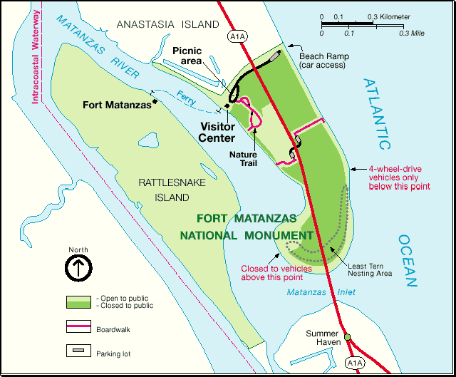
Description: A map of the Fort Matanzas National Monument and surrounding areas. The map shows the monument boundaries, the site of Fort Matanzas, areas open or closed to public access, beach ramps, picnic areas, the Intercoastal Waterway, ferry service, and a Least Tern nesting area.
Source: National Parks Service, (, : , 1994)
Map Credit: Courtesy of the National Parks Service.
SearchLicensePDF HelpGIS Help Google Earth Help Zoomify Help

 FL Maps > Local > St. Johns > Fort Matanzas National Monument, 1994