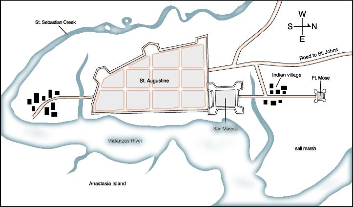
Description: A map showing the location of Fort Mose in relation to St. Augustine. Fort Mose was the first legally sanctioned free black community in present-day U. S. The map also shows the location of the Spanish fort San Marcos, the Indian Village, and the waterways and marshlands in the area.
Place Names: St. Johns, Anastasia Island, St Augustine, Saint Augustine, San Marcos, Ft. Mose, Matanzas River, St. Sebastion Creek
ISO Topic Categories:
Keywords: Fort Mose, physical, historical, physical features, other military, Unknown,2006
Source: FCIT, (Tampa, FL: Florida Center for Instructional Technology, 2006)
Map Credit: The Florida Center for Instructional Technology, University of South Florida. |
|