mapsExploring Florida
 FL Maps > Local > St. Johns > Fort Mose, 2006
Site Map 

Fort Mose, 2006


Puzzle Directions: Click on a puzzle piece and drag it where you want it. When you connect two pieces correctly, they will join together. Mix up the pieces again. View finished map in pop-up window.

Title: Fort Mose
Projection: Unknown
Source Bounding Coordinates:
W: E: N: S:

Back to Map Page
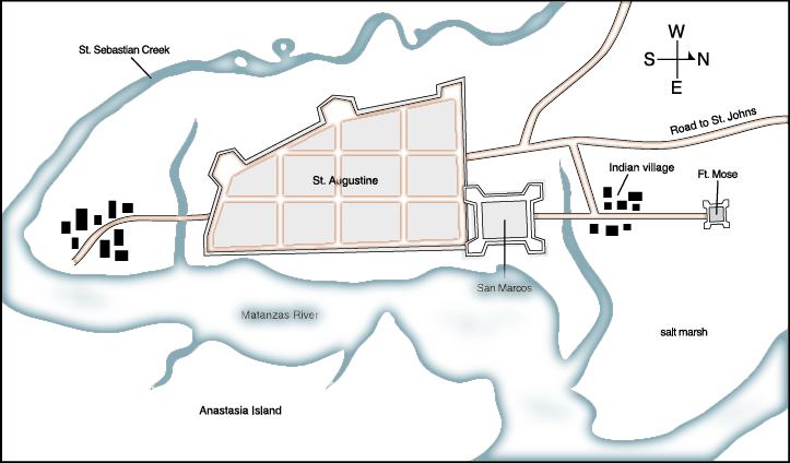
Description: A map showing the location of Fort Mose in relation to St. Augustine. Fort Mose was the first legally sanctioned free black community in present-day U. S. The map also shows the location of the Spanish fort San Marcos, the Indian Village, and the waterways and marshlands in the area.
Source: FCIT, (Tampa, FL: Florida Center for Instructional Technology, 2006)
Map Credit: The Florida Center for Instructional Technology, University of South Florida.
SearchLicensePDF HelpGIS Help Google Earth Help Zoomify Help

 FL Maps > Local > St. Johns > Fort Mose, 2006