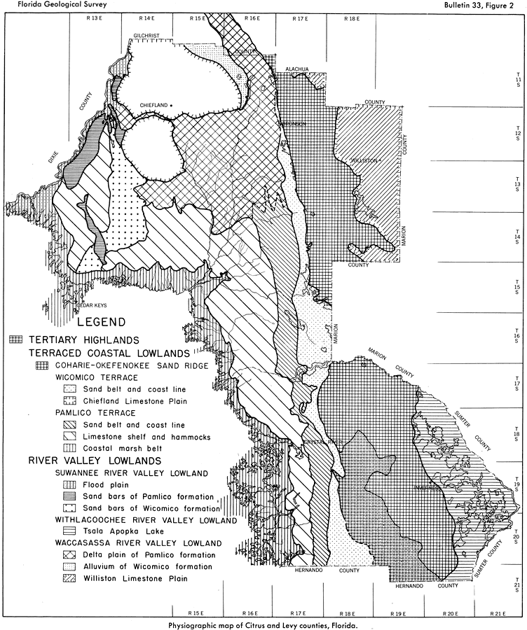
Description: This map from the Florida Geological Survey Bulletin number 33, shows the physiography of Citrus and Levy counties. These counties compose a part of the Coastal Plain Provence, and the physiography is roughly subdivided into three major units, the Tertiary Highlands, Terraced Coastal Lowlands, and River Valley Lowlands. The Terraced Coastal Lowlands are further subdivided into the Coharie-Okefenokee Sand Ridge, the Wicomico Terrace, and the Pamlico Terrace. The River Valley Lowlands are subdivided into the Suwannee River Valley Lowlands, Withlacoochee River Valley Lowlands, and the Waccasassa River Valley Lowlands.
Source: Robert O. Vernon, Geology of Citrus and Levy Counties, Florida (Tallahassee, FL: The Florida Geological Survey, 1951) 18
Map Credit: Courtesy the private collection of Roy Winkelman |
|