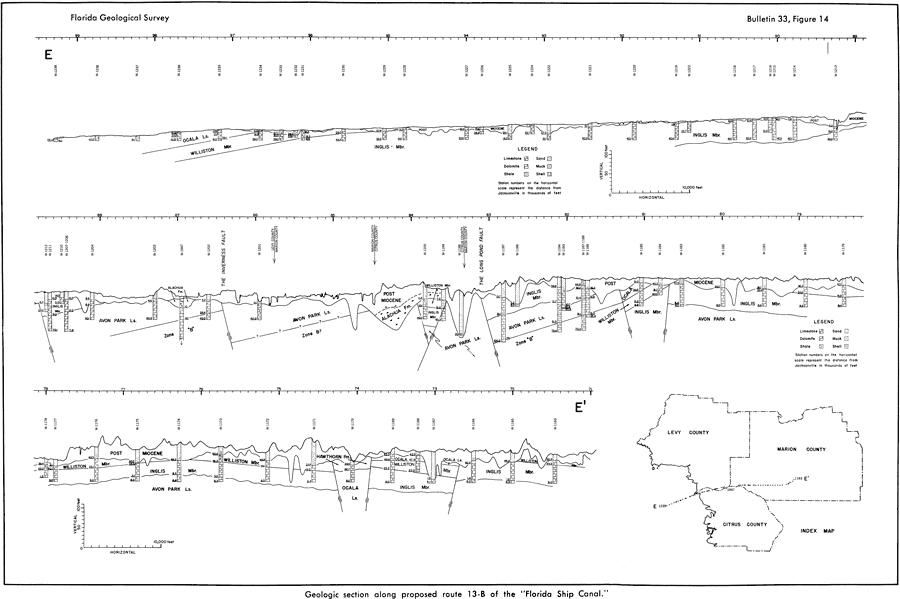
Description: This map from the Florida Geological Survey Bulletin number 33, shows a geologic section of the Florida Peninsula along the proposed Florida Ship Canal. The structures are shown to a depth of the Upper Middle Eocene Avon Park Limestone formation. Wells are numbered and representative core samples shown for each station showing makeup of limestone, dolomite, shale, sand, muck, and shell. The distance of each well from Jacksonville is shown on the horizontal scale in thousands of feet.
Source: Robert O. Vernon, Geology of Citrus and Levy Counties, Florida (Tallahassee, FL: The Florida Geological Survey, 1951) 56
Map Credit: Courtesy the private collection of Roy Winkelman |
|